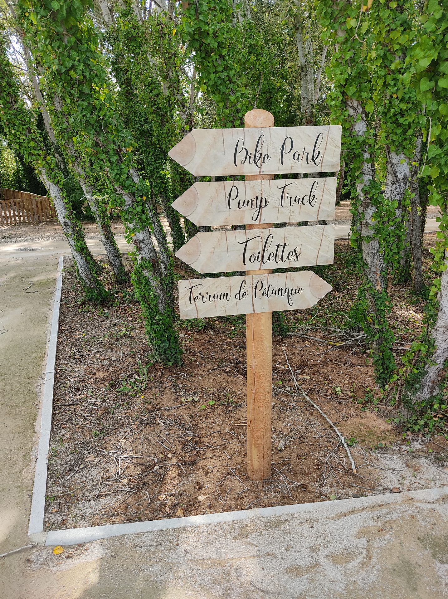
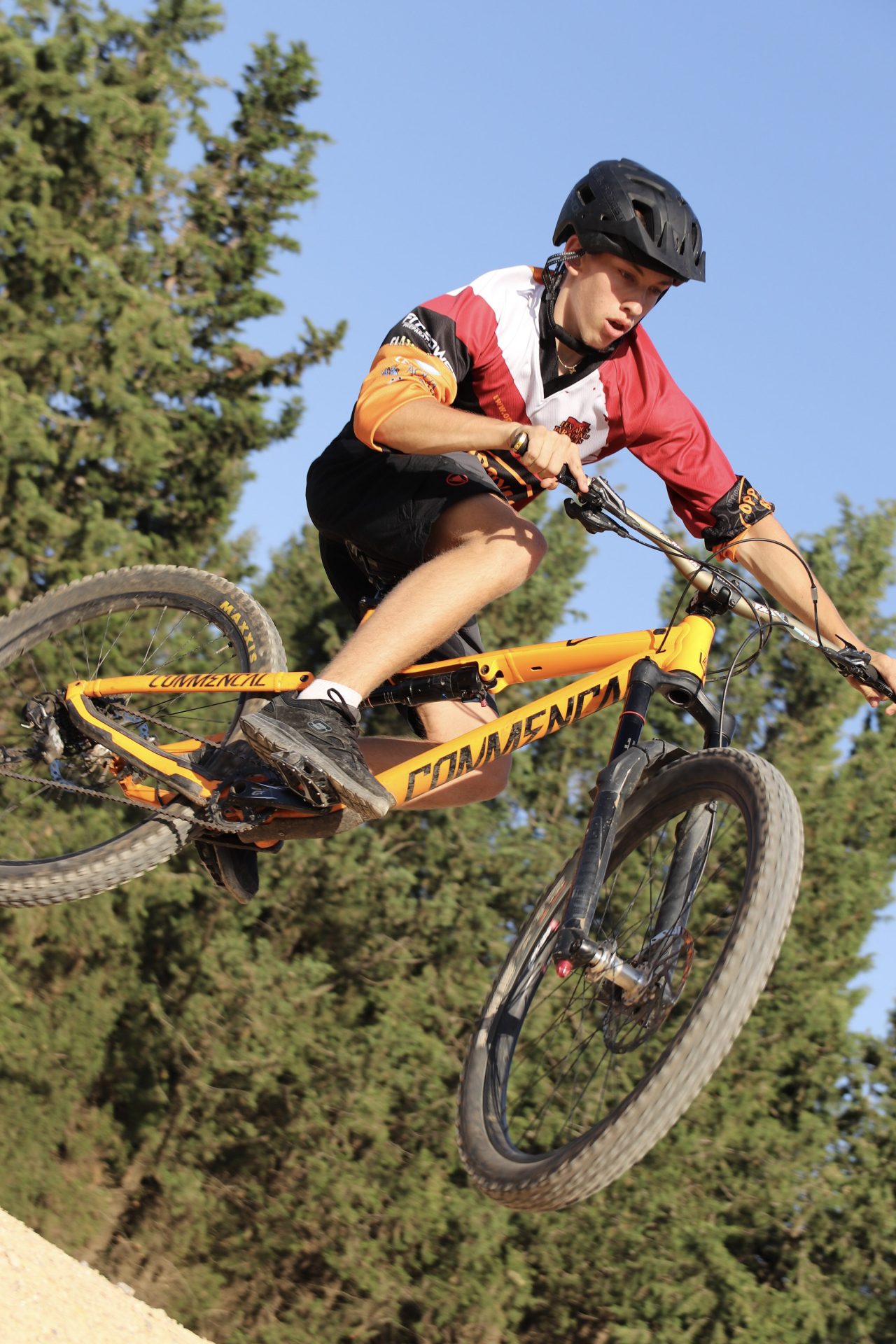
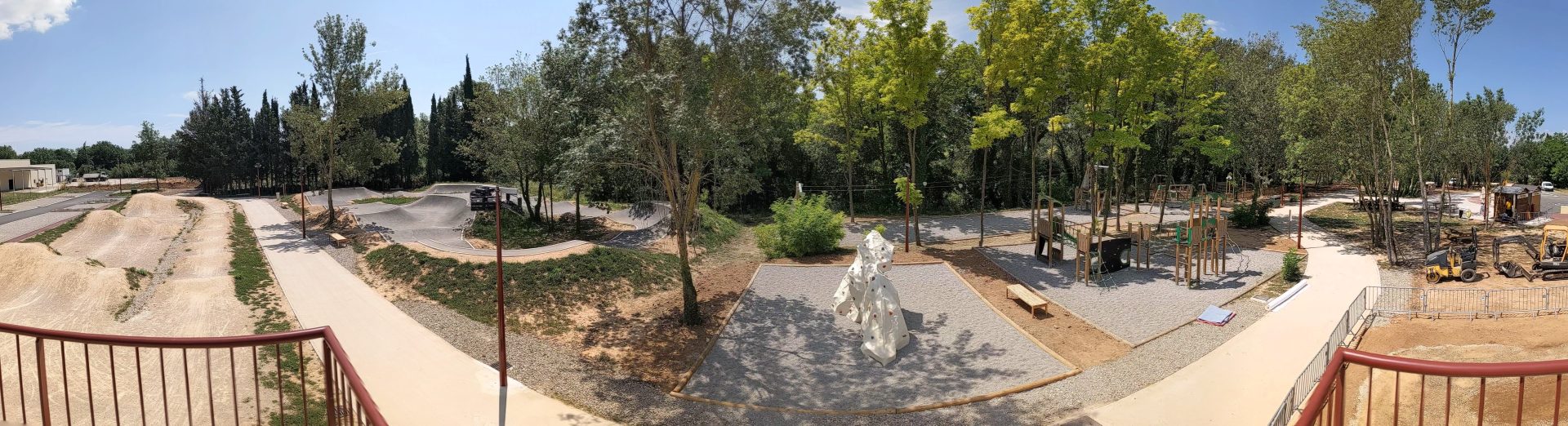
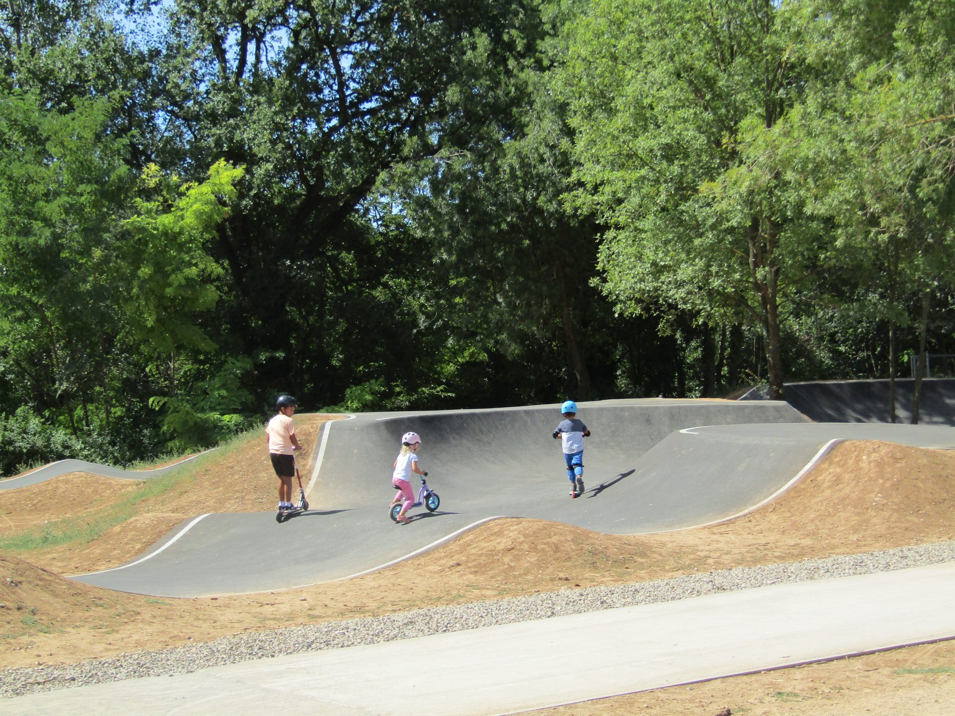
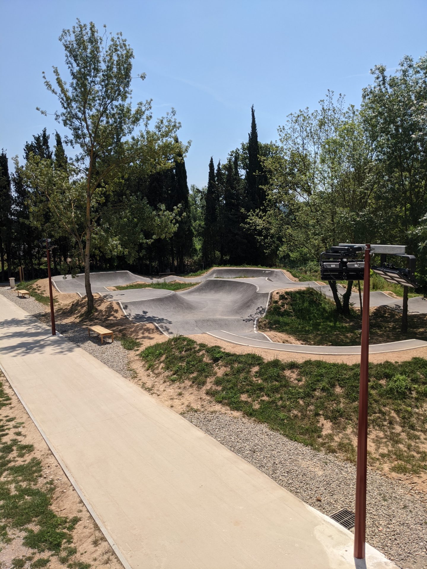
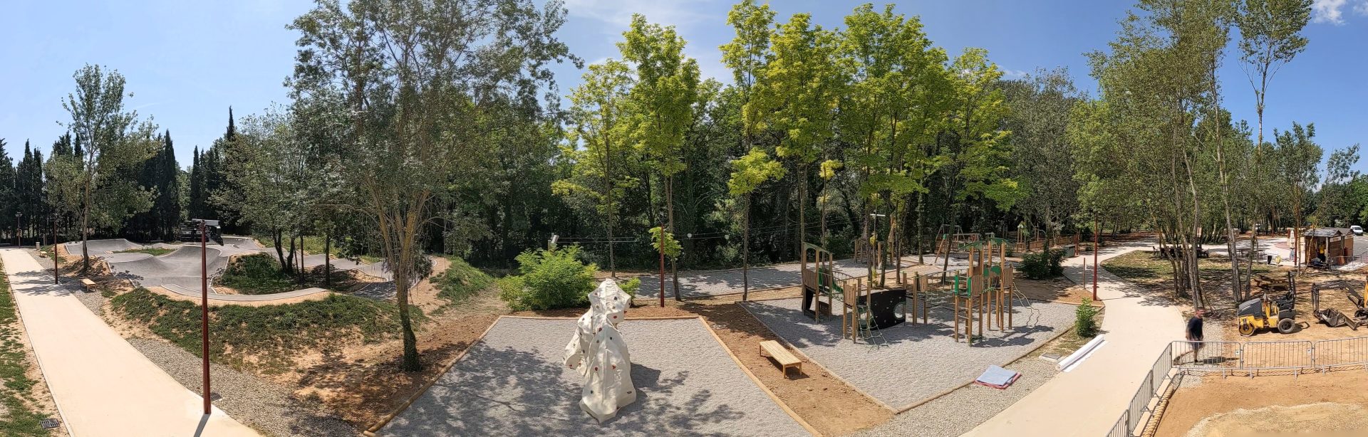
In Les Arcs, you have the possibility to hike or walk in the forest, depending on the time you have or thelevel of difficulty you want to do. For children, or sportive people, you have access to a bike park and a pump track. A cycling route is also available for a full immersion in the vinyards.
Les Arcs community forest
Les Arcs community forest covers a surface of 1560 hectares. Discover a wide diversity of flora, a diverse topography and a large number of ancient vestiges.
Eye catching sceneries, wild and bucolic, have been sculpted by two flowing streams : The Argens and the Aille River.
Les Arcs sur Argens village stands at the crossroads between the Mediterranean sea and the Var hinterland.
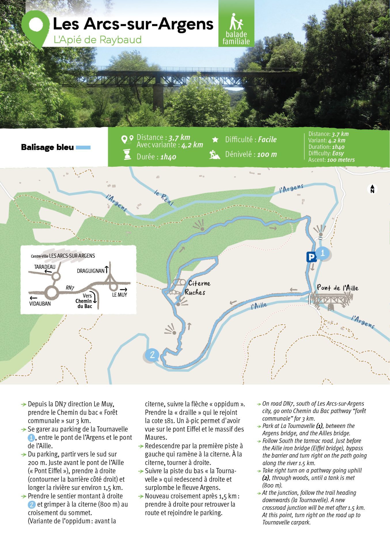
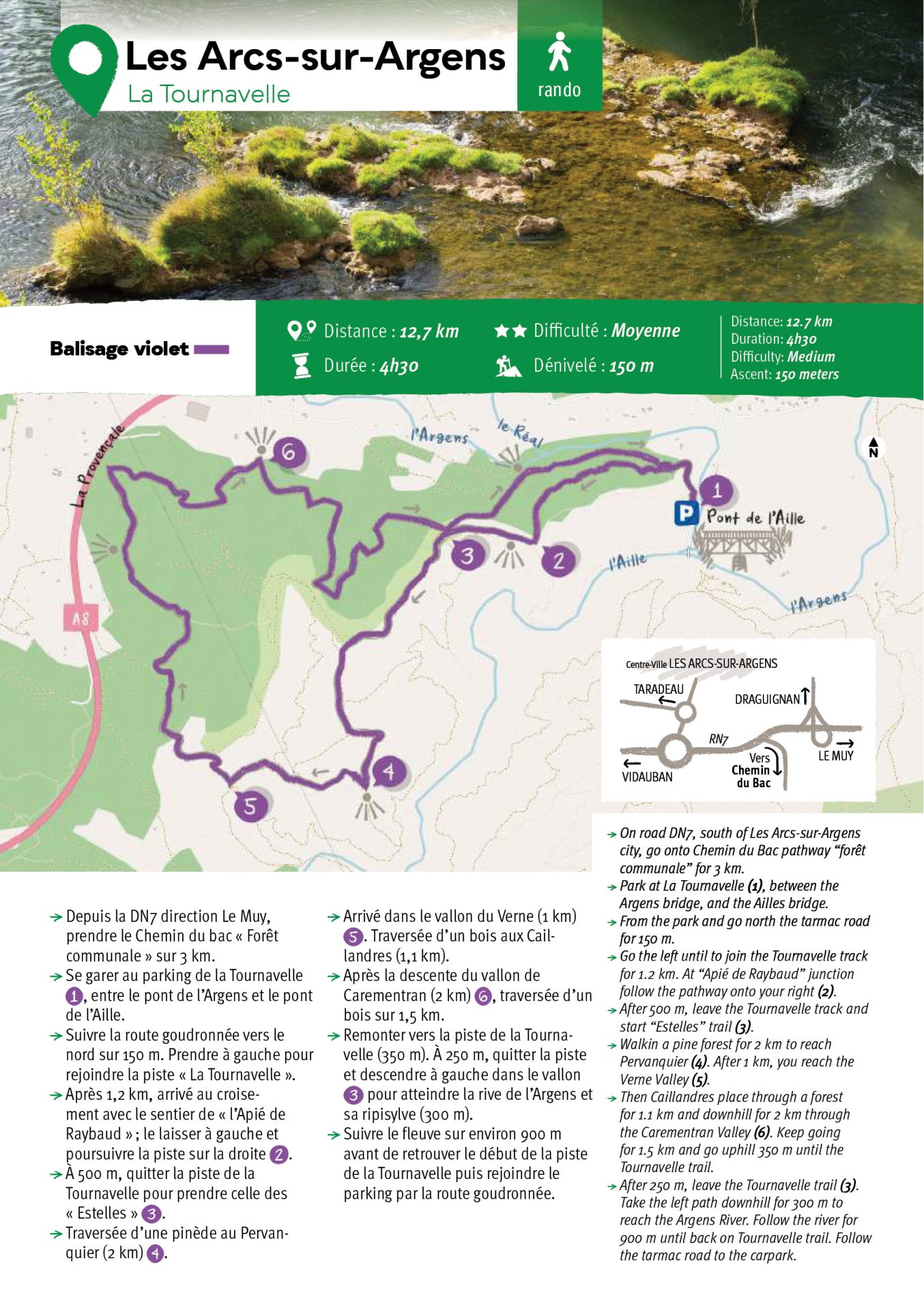
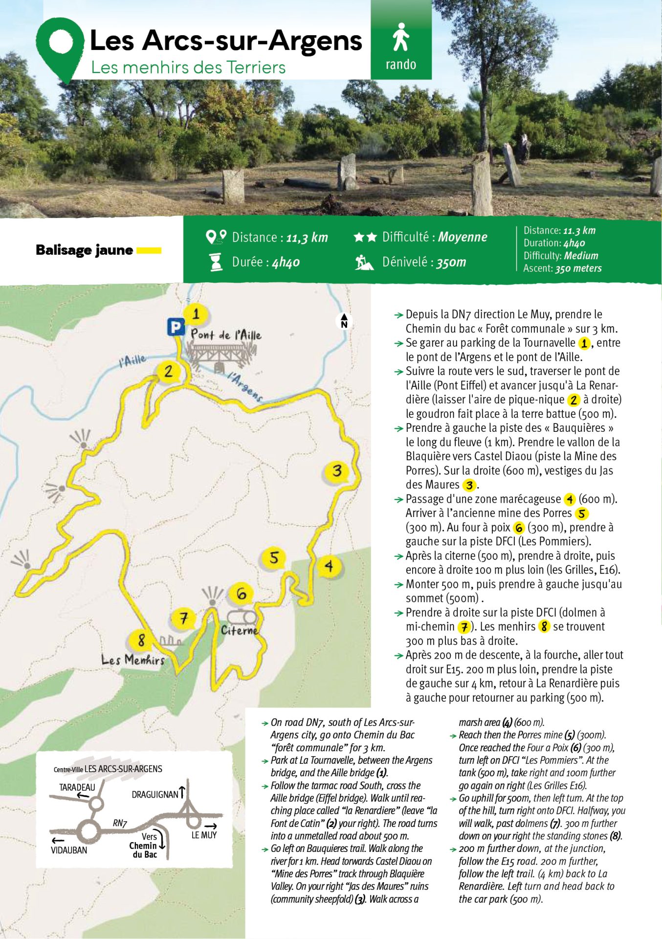
Located in the southern part of the community forest, one noticeable hiking trail unveils a rich natural environment and a remarkable archeological heritage. Ancient dwellings are scattered all along the waymarked trail. From the starting point, you can admire eyecatching sceneries. At la Mescla, the junction of the Aille and Argens rivers, you get a dazzling view on the so called « Eiffel Bridge », owing its name to the construction method used for the Eiffel tower.
You can either head torwards the Apié de Raybaud hiking trail or you can choose to carry on the tarred road up to the captured source « Font de Catin » and the Menhir des Terriers hiking trail. You will go backwards through time and come across the former barite mine « les Porres », the old pitch oven and a 5000-years-old dolmen. Several celto ligurian oppida are still visible : slate fragments, « tegulae » i.e. flat slates found at Bauquieres farm are the historic testimony of this ancient period.
Castel Diou summit, the highest in Les Arcs sur Argens, culminates at an altitude of 353 meters and offers a stunning 360° panoramic view
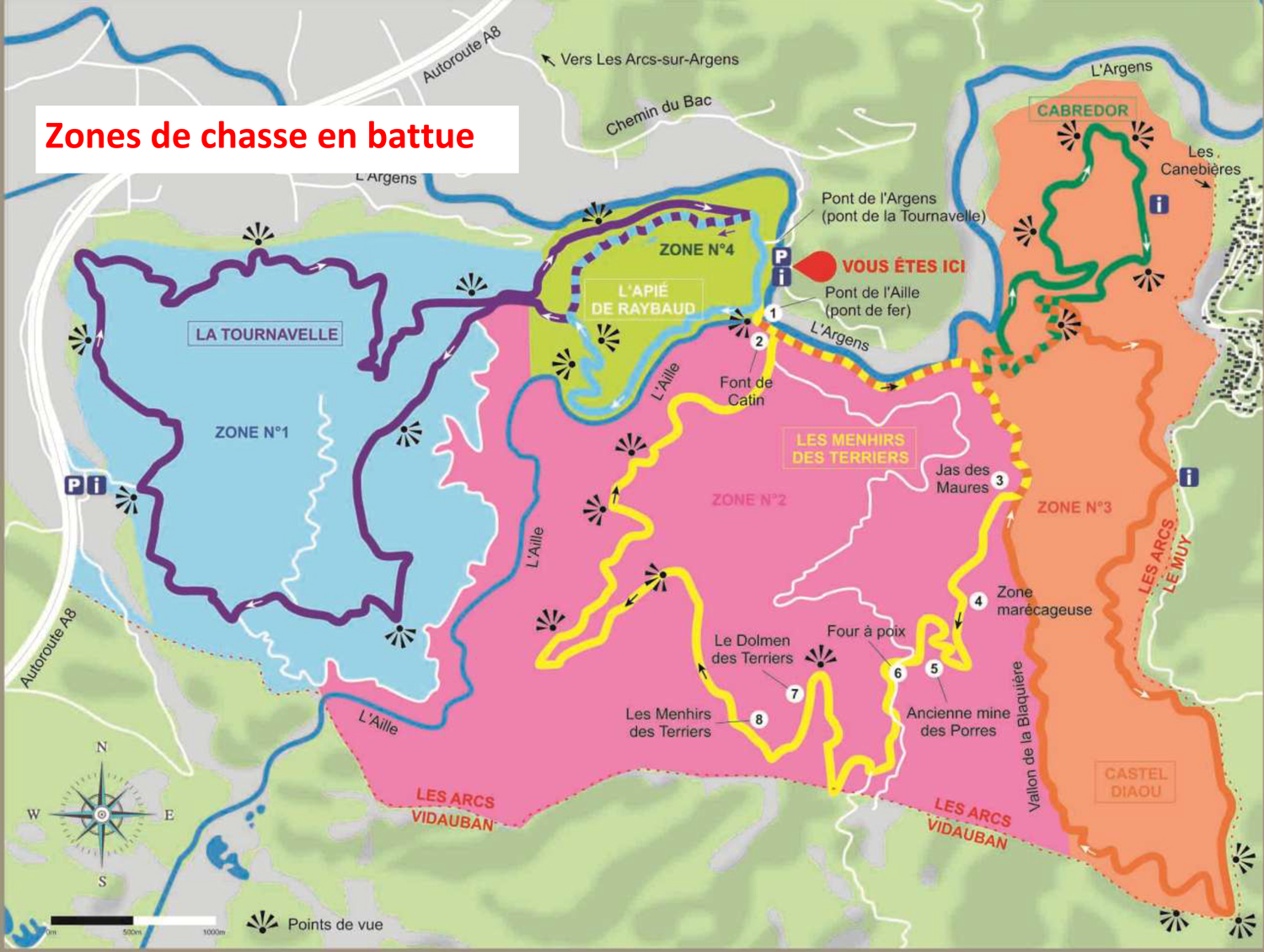
Driven hunting is scheduled from September to March. Early hunting happens in August : you must get aware of prefectural decrees and the fire risk map for the Var region.
Free access to these two leisure areas , with parental responsibility
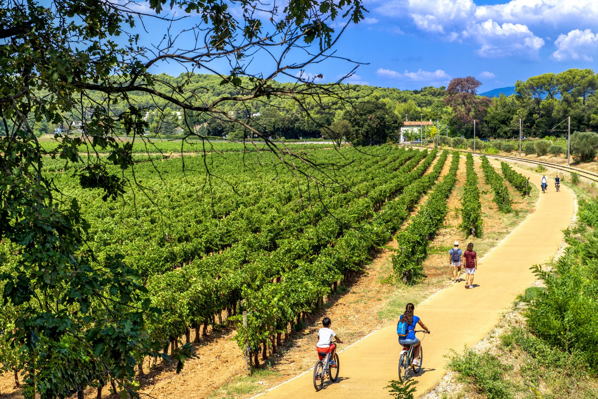
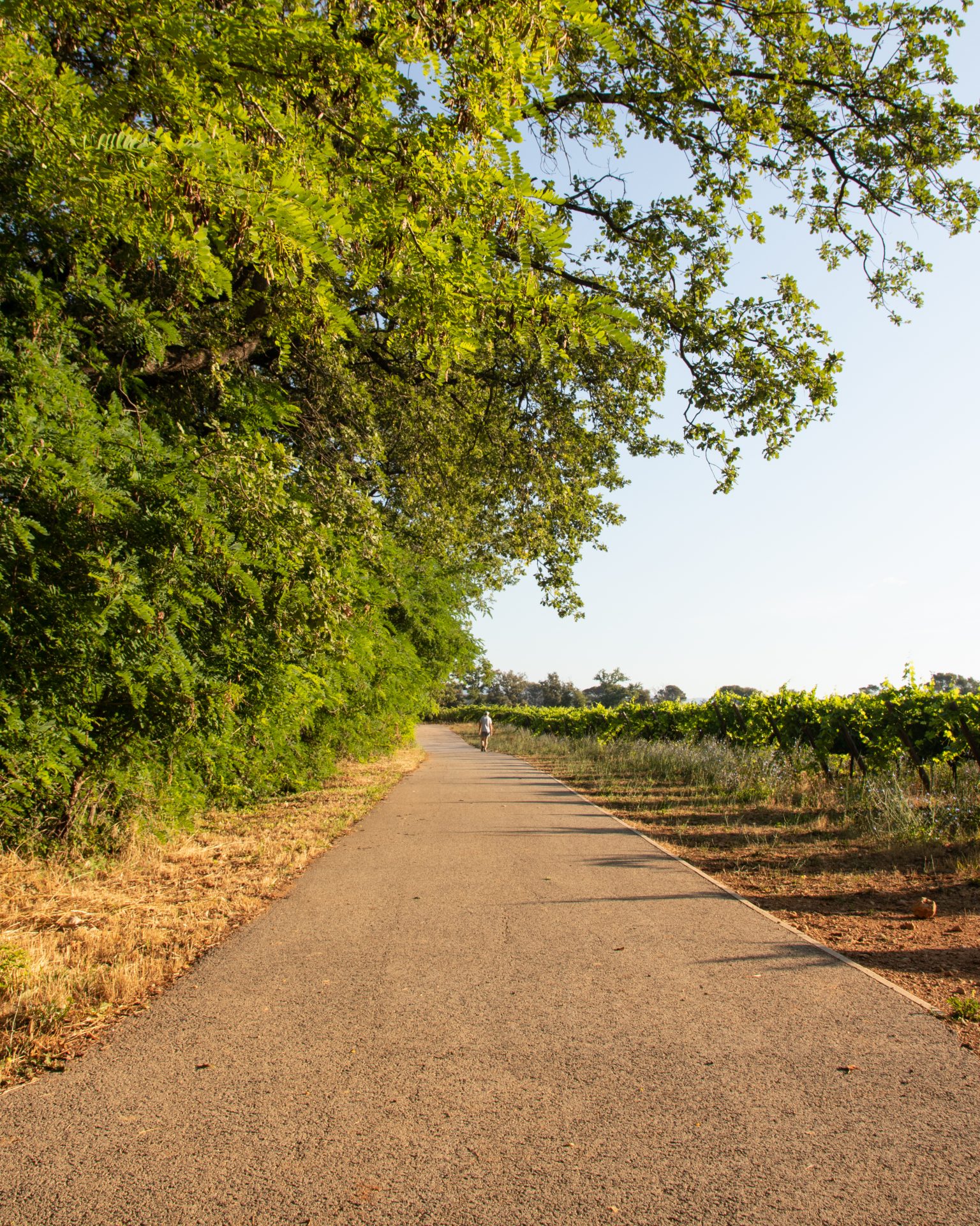
La vigne à vélo, the cycling route
Either cycling or walking, riding a rollerblade, a scooter, a skateboard or even on a stroller : following Vigne à Vélo cycling track allows for a full nature immersion in complete freedom.
Ideal for families or sportsmen, the trail goes through the vines and woodlands, along the train track, from Sainte Roseline roundabout to the train station, through the Max Carzoli strolling path. Designed by DPVa agglomeration community, the bitumen coating provides a smooth surface to ride and links villages to one another. For the more sporty, Vigne à Velo cycling track is directly connected with Euro Velo 8 cycle route, going straight from West to East, with a total span length of 70 kms